Appalachian Mountaintop Removal
Well now you can visit coal country without ever having to leave your home. Every presidential candidate and every American ought to take a few seconds to visit an ingenious new website, [ilovemountains.org/myconnection] that allows one to tour the obliterated landscapes of Appalachia.
The amazing new website allows you to enter your zip code to learn how you're personally connected to the great crime of mountaintop removal. Using this website Americans from Maine to California can see these mountains and the communities that were sacrificed to power their home.
The site puts a human face on the issue by highlighting the stories of families living in the shadows of these mines.
This new website finally exposes this national disgrace for every American to witness.
- Robert F. Kennedy, Jr. from The Huffington Post
Update: As of May 2009, the Environmental Protection Agency has objected to 6 Mountaintop Removal coal mining projects out of 48 reviewed (source), after putting a hold on 150-200 proposed mining projects for closer examination (source). The Obama Administration is being called upon by environmental activists to reverse a last-minute Bush Administration rule that allows dumping of debris within 100 ft of streams (source). Dumping of waste within the 100 ft. buffer zone had previously been illegal since 1983.
Introduction
Mountaintop removal coal mining is changing the American landscape on a scale that is hard to comprehend unless you see it from the air. Anyone who has ever flown in a small aircraft over southern West Virginia or eastern Kentucky will never forget the experience of seeing the massive scale of destruction - mountain after mountain blown up and dumped into valleys as far as the eye can see. Mountaintop removal affects more than mountains and streams, however; it is threatening to displace and destroy a distinctly American culture that has persisted in the Appalachian Mountains for generations. Appalachian people working to save their communities have long dreamed of ways to fly reporters, decision-makers, and thousands of other Americans over the Appalachian coalfields to see this destruction first hand - and then to visit their communities to hear stories of people who endure the consequences of what some have called "cheap energy." Now, thanks to Google Earth, a pretty good approximation of that tour is accessible to anyone who has a computer and a high-speed internet connection, extending our reach by millions of people. As Mary Anne Hitt, Executive Director of Appalachian Voicessaid: "Google Earth has transformed how we think about the issue, because it not only allows millions of people around the world to see and explore the impact on our region, but it also allows people right here in Appalachia to see for themselves what is going on in the mountains above their homes and communities." The Appalachian Mountaintop Removal layer was produced by Appalachian Voices as the centerpiece ofiLoveMountains.org, an online action and resource center launched in September of 2006. Through iLoveMountains.org, 7 grassroots organizations from across Appalachia are using cutting edge technology to reveal the devastation of their mountains and communities and to build a national movement to end the practice. In addition to Appalachian Voices, partners in iLoveMountains.org include Coal River Mountain Watch,Keeper of the Mountains Foundation, Kentuckians For The Commonwealth, Ohio Valley Environmental Coalition, Save Our Cumberland Mountains, and Southern Appalachian Mountain Stewards.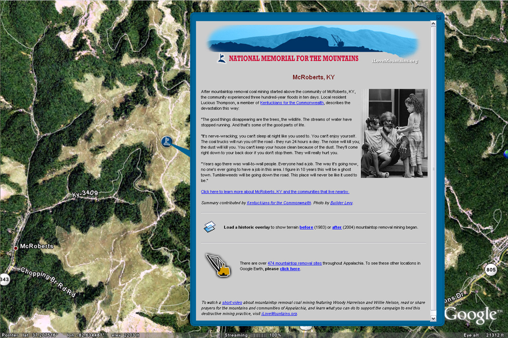
Our Goals
As we've become more experienced in using the Google Earth platform, our goals for our Appalachian Mountaintop Removal layer have become increasingly ambitious. When we launched iLoveMountains.org, we wanted to lift the cloak of secrecy that for decades had hidden mountaintop removal not only from the American people, but also from the communities directly below the mine sites.Initially, our goals were to:
- Convey the massive scale of destruction caused by mountaintop removal coal mining while connecting users to the human communities that are impacted and the human tragedies caused by the destruction.
- Link users to the web where they can learn more about mountaintop removal, read about the effort to end it, and, most importantly, take action to help stop it.
- Provide a platform to create and engage a network of supporters who we can partner with on a long-term basis to end mountaintop removal.
- Develop a resource to educate and regularly update decisionmakers, media, bloggers and other Americans about mountaintop removal.
- Create a simple and intuitive interface to show Americans how they are connected to mountaintop removal through their light switches.
- Use the new flash video capabilities of Google Earth to create a YouTube - based "America's Most Endangered Mountains" layer to show, as only the high-impact medium of video can, not just what's been destroyed but also the beauty and value of the mountains, forests and communities in Appalachia that can still be saved.
- Design a layer that shows how alternatives to coal from mountaintop removal could easily meet America's energy needs.
Our KML Implementation
Our KML implementation thus far has been completed in two distinct stages. The initial KML consisted of a 4 layer map with links to various other KML resources accessed through description balloons.The initial Appalachian Mountaintop Removal layer, [which currenly resides in the Global Awareness folder of Google Earth] included:
- A user's guide to give people a road map of how to use the many resources for learning about mountaintop removal provided in the KML.
- A high-resolution tour of a mountaintop removal site.
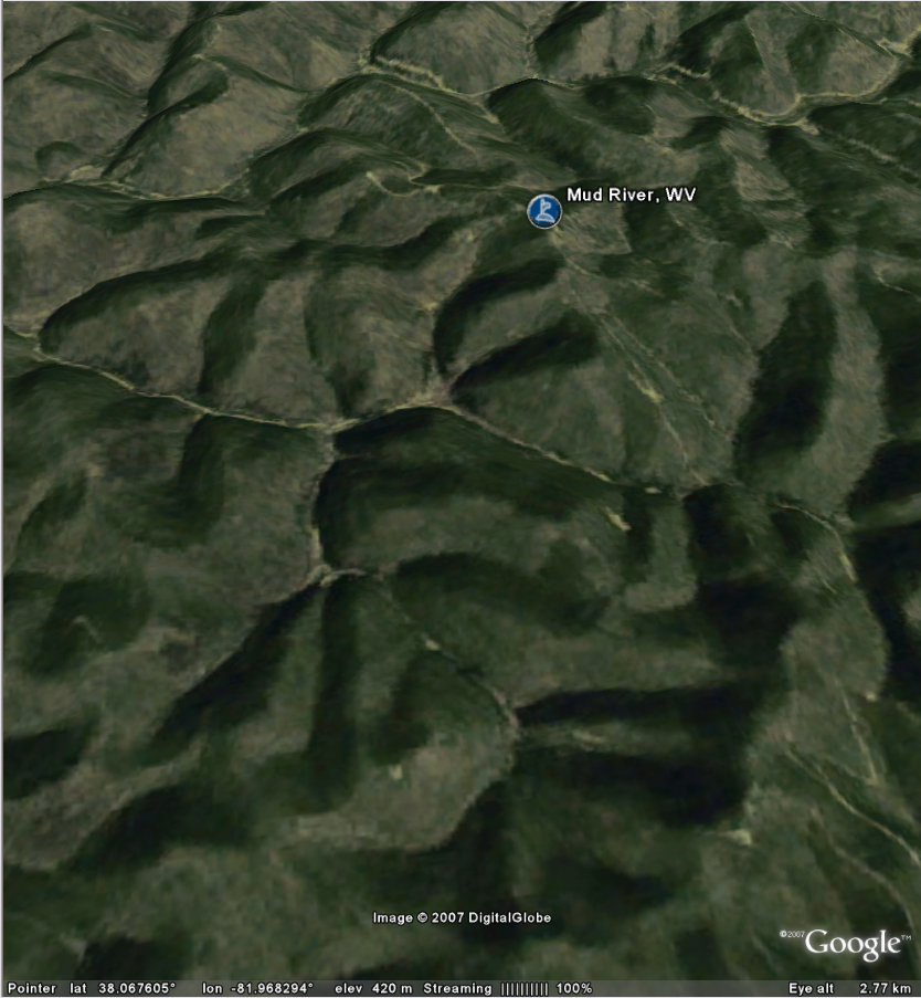
- The locations of 22 featured mountains and communities impacted by mountaintop removal. The description balloons for this layer tell a brief but compelling story about the mountain and provide links to iLoveMountains.org, a web site where visitors can watch videos hosted on YouTube, see photos hosted on Flickr, and read stories about the mountain. There are also links that allow users to view the locations of nearly 500 additional mountains that have been leveled by mountaintop removal operations.
- Before and after overlays. Using Google Earth to overlay aerial photos from various time periods we were able to construct high-resolution before-and-after views for each of the 22 mountains that were memorialized. Recent aerial imagery was obtained from state digital ortho quadrangles, and older imagery was mostly obtained from the USGS National High Altitude Photography (NHAP) program.

| Pin this badge on your site. |
Type in your zip code above to get a
Google Earth file of your connection.
- A data set from the Mine Safety and Health Administration that provides detailed information and geographic locations of mines.
- A data set from the Energy Information Administration that tracks monthly coal purchases by every power plant in the U.S.
- Data provided by the Environmental Protection Agency that contains detailed information and geographic locations of every power plant in the U.S.
- A data set purchased from Intelimap Inc. that associates each U.S. zip code with one or more electric service providers.
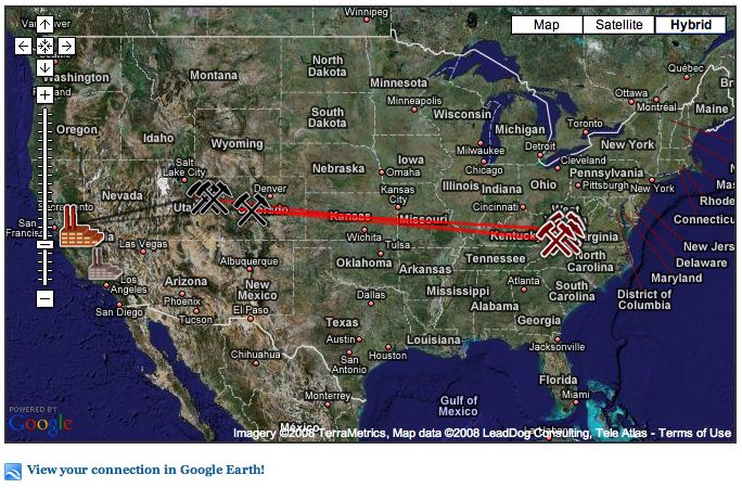 | 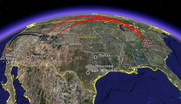 |
| The Google Maps mashup from "My Connection". Note the link to the Google Earth KML file in the lower left hand corner. | The Google Earth view of the "My Connection" website. |
Exposure, Recognition, and Impact
The use of Google Earth has transformed the way we think about our work, and has brought the mountaintop removal issue to a massive new audience. The site has received major national media coverage and recognition for innovation. Images and videos from our KML layers have been presented to dozens of live audiences, ranging from small church groups and rotary clubs to large conferences and keynote presentations at environmental events.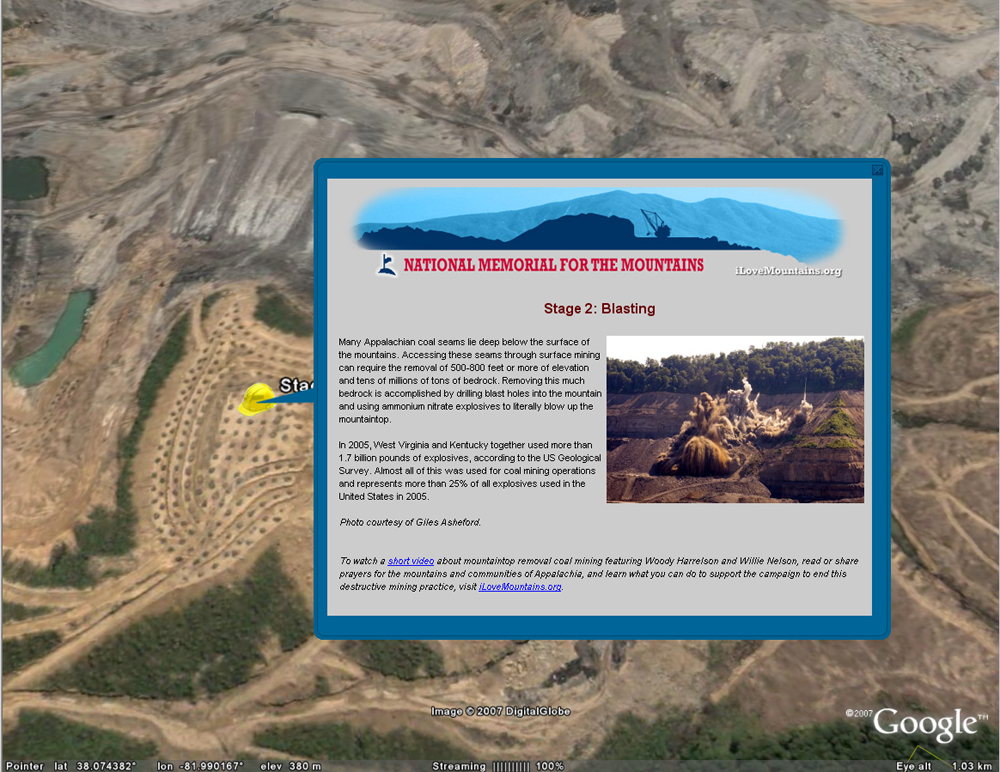
Illustration of the mountaintop removal blasting process;
dynamite holes visible in the imagery.
Enlarge image
dynamite holes visible in the imagery.
Enlarge image
- The Wall Street Journal, "Activists Start Googling." Kevin J. Delaney. Nov. 15, 2007.
- Dot Earth: The New York Times Science Blog, "Connecting the Energy Dots." Andrew C. Revkin. Nov. 16, 2007.
- Robert F. Kennedy, Jr. in The Huffington Post, "Coal's True Cost." Nov. 29, 2007.
- Winston-Salem Journal, "Site shows effects of mining." Monte Mitchell. Nov. 30, 2007.
- Contribute Magazine, "The Whole World is Watching." Patricia Youngquist. Sep./Oct., 2007.
- Sierra Magazine, "Eyes In the Sky and On Your Desktop." Gregory Dicum. Sep./Oct. 2007.
- CNET, "Do-gooders Doing Google Earth." Stefanie Olsen. June 7, 2007.
- Associated Press, "Eco Groups Use Online Maps in Mine Fight." Samira Jafari. Nov. 4, 2006.
Advice To Others
We have heard from dozens of people who are considering developing projects on Google Earth, and our main messages to them have been:- It's easier than you think. Don't feel like you need to contract out expensive consultants to develop a project. Take the time to learn a little about KML development, and you'll be surprised how much you can accomplish on your own.
- Your Google Earth KML project can be as sophisticated and rich as you imagine. You can start with a simple design and iteratively refine and hone it over time, adding greater sophistication as you move forward.
- It's more powerful than you think. Google Earth and Google Maps mashups with KML provide a very flexible platform which is constantly improving. You can be very creative about what information you want to provide and how you provide it.
Links
http://www.ilovemountains.org/memorial/http://www.ilovemountains.org/memorial_tutorial
http://www.ilovemountains.org/multimedia/#ge
http://www.ilovemountains.org/myconnection
http://www.thepetitionsite.com/takeaction/679588629
Authors
Mary Anne Hitt, Executive DirectorMatthew Wasson, Ph.D, Conservation Director, Appalachian Voices
Contact
Mary Anne Hitt, Executive Directoremail: mahitt@appvoices.org

No comments:
Post a Comment