Tuesday, May 10, 2011

File:Bonnet Carre Spillway aerial view northeast.jpg


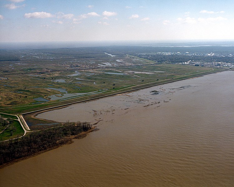
The text is run together, but it's a good pic of the spillway.and dam....The entire plain on the left, separated from the Mississippi by a man made toy called a dam, is the spillway leading to the lake 5.5 miles away..

From Wikipedia, the free encyclopedia
Full resolution (1,500 × 1,200 pixels, file size: 703 KB, MIME type: image/jpeg)
Description
English: The opening of the Bonnet Carré Spillway on the Mississippi River. The spillway is designed to spill water from the river into Lake Pontchartrain during flooding of the river. The spillway is located about 12 miles (20km) west (upriver) of New Orleans, Louisiana, USA. View is to the northeast. Lake Pontchartrain can be seen in the far distance, about 5.5 miles (9 km) distant.
Date
5 May 1999
Source
U.S. Army Corps of Engineers Digital Visual Library
Image page
Image description page
Digital Visual Library home page
Author
Michael Maples, U.S. Army Corps of Engineers
Permission
(Reusing this file)
Public domainThis image or file is a work of a U.S. Army Corps of Engineers soldier or employee, taken or made during the course of the person's official duties. As a work of the U.S. federal government, the image is in the public domain.
United States Army Corps of Engineers logo.svg
Camera location
This and other images at their locations on: Google Maps - Google Earth - OpenStreetMap(Info)

File history

Click on a date/time to view the file as it appeared at that time.

Date/TimeThumbnailDimensionsUserComment
current04:17, 6 April 2007Thumbnail for version as of 04:17, 6 April 20071,500×1,200(703 KB)DanMS({{Information | Description = {{en|The opening of the Bonnet Carré Spillway on the Mississippi River. The spillway is designed to spill water from the river into Lake Pontchartrain during flooding of the river. The spillway is located about 12 miles ()
The following pages on the English Wikipedia link to this file (pages on other projects are not listed):
No comments:

Post a Comment